Highpoints
I really like lists. I like making a list of things I need or want to do and then marking completed items off. The most common lists I make involve chores around the house. I almost never complete those lists. Granted I don't complete alot of my lists. But it's still something I like to do. I'm sure I fit into some psychological profile but I don't know what that is. Anyway, one of my many current lists involves reaching the high points in each of the 50 states. This is actually a very possible feat however for me it will likely take many many years. (And I'm not sure yet what I'll do when it comes time for Alaska. Not only is Mt. Mckinley extremely physically demanding and dangerous, it also requires several weeks and almost $10,000. But I'll cross that bridge when I come to it). The majority of the highpoints are very easy and sixteen of them are actually drive-ups. The hardest part with those ones is actually finding them. The highest highpoint is obviously Mt. Mckinley at 20,320'; the lowest is Florida's Lakewood Park at a whopping 345'. As of right now I have completed 9 of the 50, which I guess isn't too bad since I decided to do this only about a year ago. By the way, probably my main inspiration for wanting to do this was a book a friend gave to me called "To The Top" by Joe Glickman and Nels Akerland. I like it because they are two reasonably normal guys, not considered "professional'' climbers. It's a good book with alot of cool pics. Anyway, the next few posts will be some quick recaps of my first 9 summits in the order I climbed them. A few of them were already relayed in my Black Hills postings.
Summit #1
Guadalupe Peak, Texas 8,749' 2/9/06
In February '06 I went driving for a few weeks. In a nutshell I went as far east as Arkansas to visit my grandparents, then north to Denver then back to the southwest then home. Lots and lots of stops on this trip but I don't necessarily want to blog about the whole roadtrip (that would take forever), just the highpoints.
My first highpoint stop was in Texas. If you've ever driven across Texas you know that for the most part it is a pretty flat and uneventful state. The Guadalupe Mountains are in the west on the border with New Mexico and are actually established as a national park. They are a desert range with forested and verdant higher elevations and canyons. The hike itself is 8.4 miles roundtrip with an elevation gain of 2,950' which makes for a fairly strenuous walk. The weather was clear in the 60's with a cold wind on the summit. Here are a few pics:
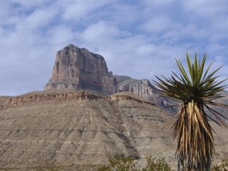
View from the south. The actual peak sits behind El Capitan.
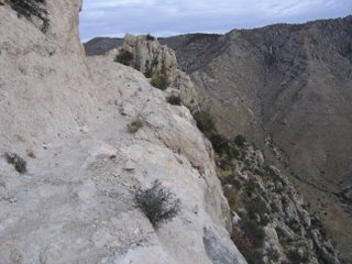
A fun section of the trail.

Another section of the trail.
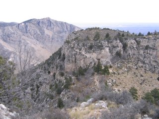
Looking back down trail.
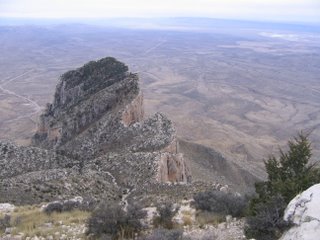
Looking down on El Capitan
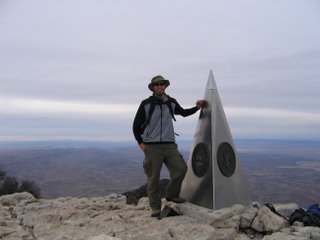 The Summit. The stainless steel pyramid is a tribute to the air mail pilots who pioneered a route through the mountains.
Summit #2
Mount Magazine, Arkansas 2,753 2/17/06
I visited my grandparents in Texarkana for a week or so then continued north for the highpoint of the natural state. This highpoint sits on a bluff overlooking the Arkansas Valley. Not really a hike, more of a casual walk. About a mile roundtrip with an elevation gain of 225'. The actual highpoint itself is called Signal Hill and it sits in Mount Magazine State Park. There is no view from the top as it is surrounded by forest. But some of the views from other spots in the park are rather beautiful. Temperatures were in the mid 30's with some wind and drizzle.

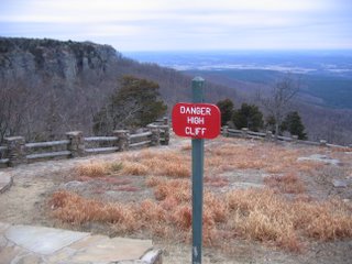

The Summit.
Summit #1
Guadalupe Peak, Texas 8,749' 2/9/06
In February '06 I went driving for a few weeks. In a nutshell I went as far east as Arkansas to visit my grandparents, then north to Denver then back to the southwest then home. Lots and lots of stops on this trip but I don't necessarily want to blog about the whole roadtrip (that would take forever), just the highpoints.
My first highpoint stop was in Texas. If you've ever driven across Texas you know that for the most part it is a pretty flat and uneventful state. The Guadalupe Mountains are in the west on the border with New Mexico and are actually established as a national park. They are a desert range with forested and verdant higher elevations and canyons. The hike itself is 8.4 miles roundtrip with an elevation gain of 2,950' which makes for a fairly strenuous walk. The weather was clear in the 60's with a cold wind on the summit. Here are a few pics:

View from the south. The actual peak sits behind El Capitan.

A fun section of the trail.

Another section of the trail.

Looking back down trail.

Looking down on El Capitan
 The Summit. The stainless steel pyramid is a tribute to the air mail pilots who pioneered a route through the mountains.
Summit #2
Mount Magazine, Arkansas 2,753 2/17/06
I visited my grandparents in Texarkana for a week or so then continued north for the highpoint of the natural state. This highpoint sits on a bluff overlooking the Arkansas Valley. Not really a hike, more of a casual walk. About a mile roundtrip with an elevation gain of 225'. The actual highpoint itself is called Signal Hill and it sits in Mount Magazine State Park. There is no view from the top as it is surrounded by forest. But some of the views from other spots in the park are rather beautiful. Temperatures were in the mid 30's with some wind and drizzle.


The Summit.

3 Comments:
i like the pics of you in arkansas....good facial expressions, only lacking jazz hands. also that hat in texas is awfully outdoorsy, very impressive. you should wear that hat to a hiker's nightclub or something, a place where the beer flows like wine.
desi
jazz hands?
so, where are the other 7?
Post a Comment
<< Home